Build Smarter Cities with Data Insights
46% of organizations are using external data sources to detect industry trends and get insights that drive efficiency, improve safety, and inform long-term planning decisions. But data is often siloed across different systems, making it hard to understand the real-world dynamics of how citizens and goods move through your city. At Samsara, we're investing in tools so you can use data to create safer, more efficient, more sustainable communities.
Overview
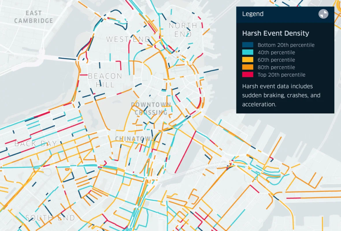
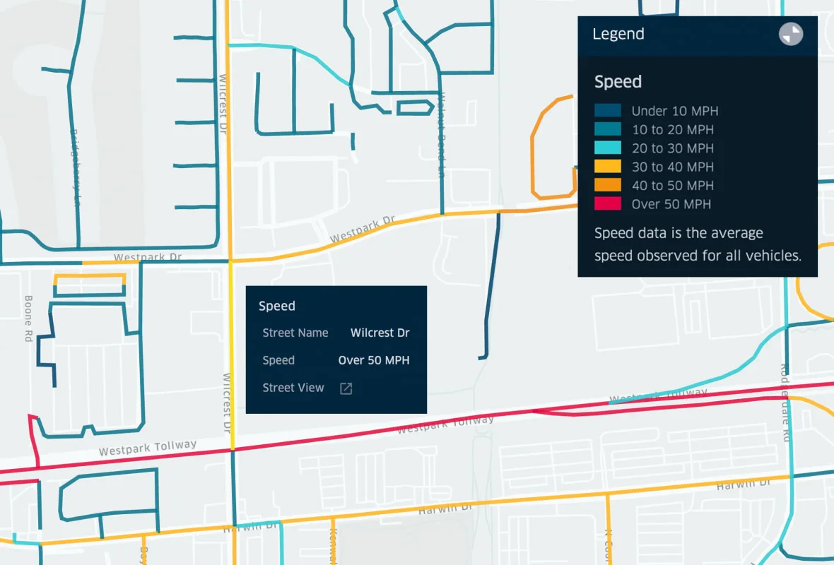
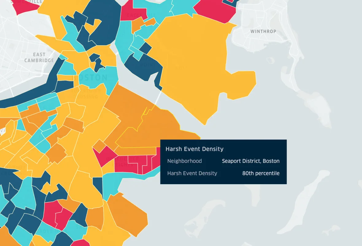
Samsara aggregates and anonymizes data from over half a million commercial vehicles. Key vehicle behaviors, such as speed and harsh events, are visualized in an easy-to-explore dataset.
View Interactive Map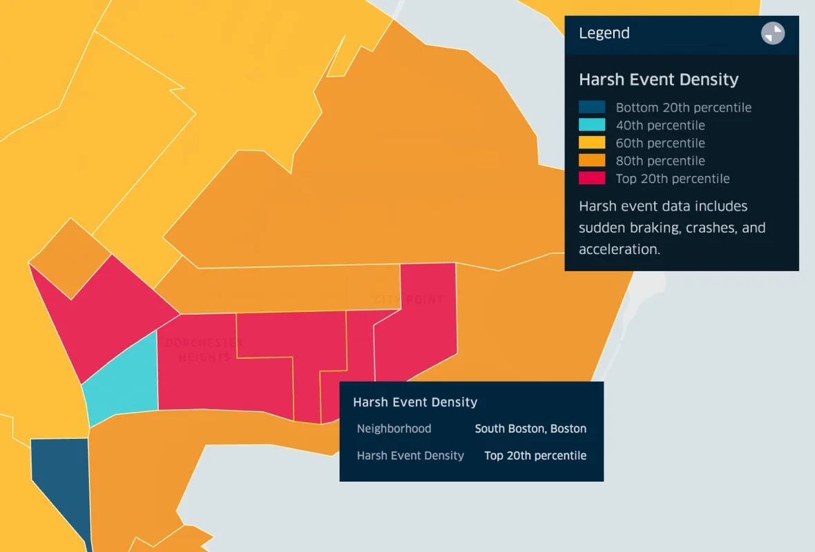
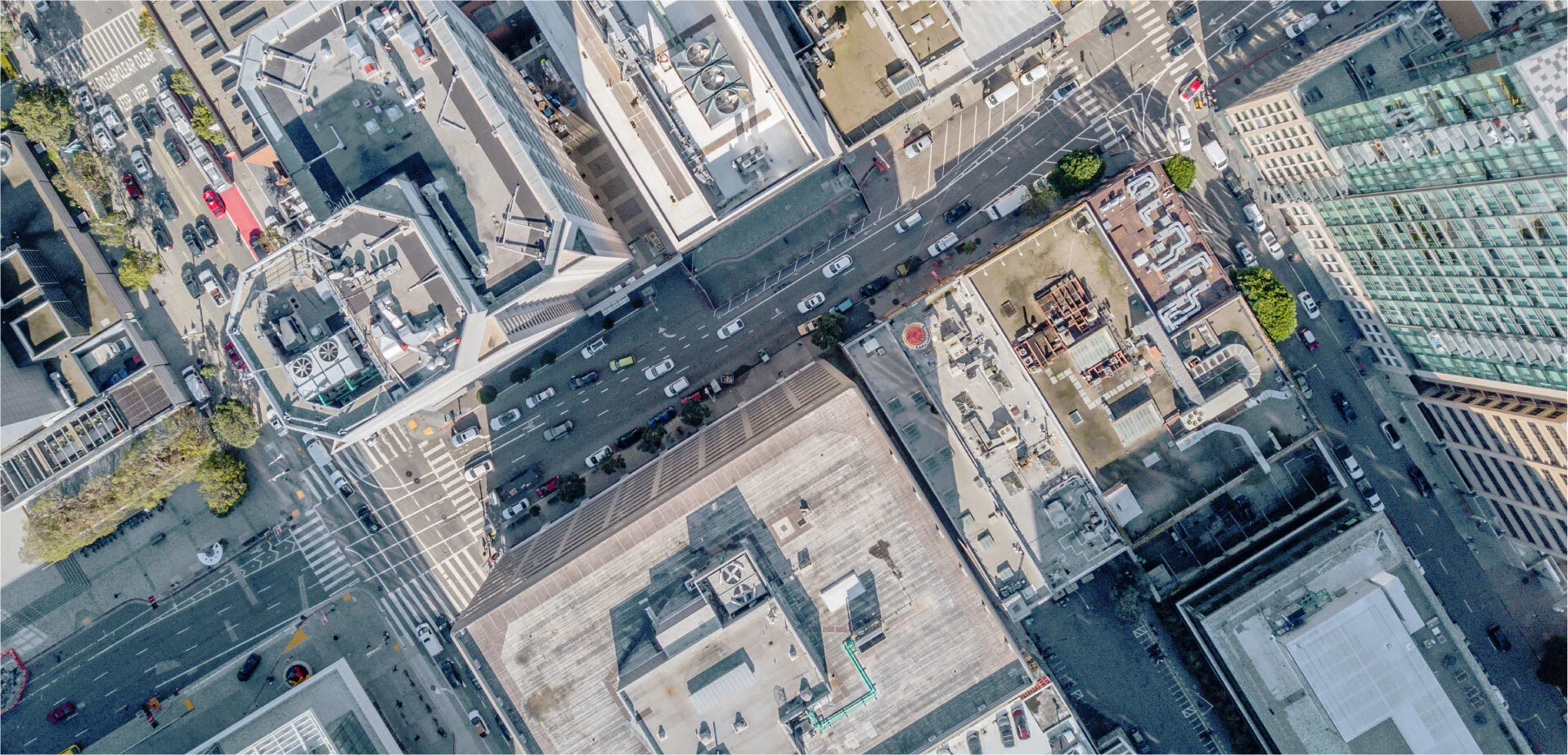
How IoT sensors are transforming cities
City leaders, urban planners, and public works officials are turning to technology to connect their cities' operations. How are leaders incorporating smart technology into their decision-making? Read on to learn how IoT applications can deliver insights to help allocate resources more efficiently, improve quality of life, contribute to sustainability goals, and more.
Read More
On-demand webinar
Key COVID-19 Trends
How has the varied response to to COVID-19 affected communities across the country? We dug into the data to find out.
Watch NowThere is a lot that goes into delivering the services that people have come to expect. Collecting good data is important in making decisions in how we deliver services.”
CHRIS LAGERBLOM
City Manager, City of Fort Lauderdale
Watch Video
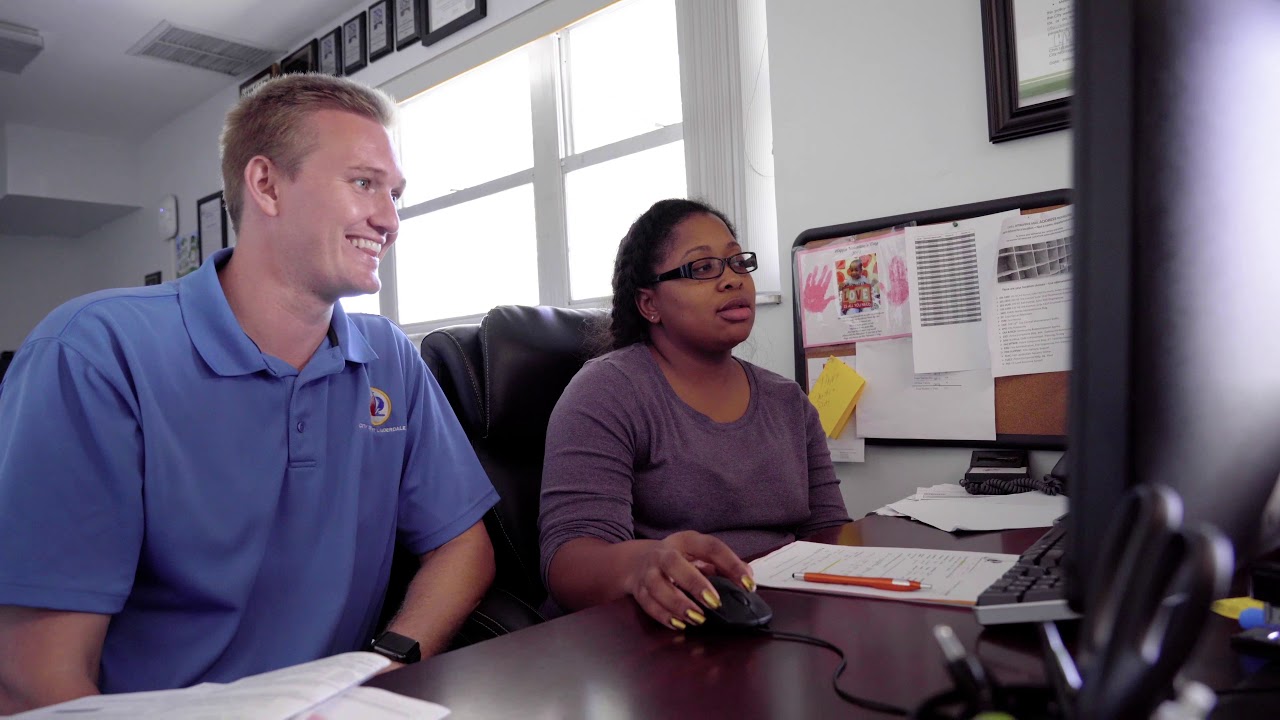
Connected city tour: Fort Lauderdale
See how the City of Fort Lauderdale connects operations across 11 departments and 1,700 assets to improve citizens’ quality of life and achieve “accountability on the fly”.
Smarter Cities Start with Smarter Fleets
Budget constraints can make it difficult for public sector leaders to implement smart city technology all at once. So how can you kickstart your smart city initiative? Download our free guide for tips on how to get started.
Get your guide