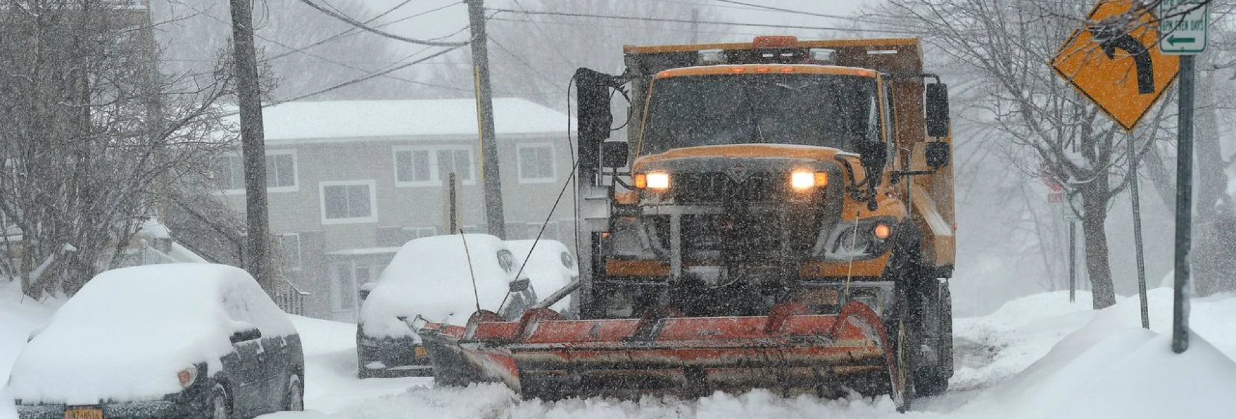
The City of Syracuse decreases citizen calls by 30% with a custom-built integration
How the City of Syracuse streamlined their snow operations
Highlights
Real-time visibility into the location and status of snowplows enables the Department of Public Works (DPW) team to track service coverage and optimize routes using advanced cloud-based technology, increasing operational efficiency.
Auto-uploaded still images and on-demand video retrieval provide remote visibility into road conditions and on-road incidents, improving route planning and helping the DPW investigate citizen concerns faster and more accurately.
Seamless API integration with Esri makes it possible for the DPW to share a publicly-accessible map of service coverage with residents, increasing transparency and leading to a 30% decrease in citizen calls about snowplow service.
Challenge
Syracuse is one of the snowiest cities in America, receiving on average 104 inches of snow each year. To ensure their streets are safe during the winter, their DPW manages a fleet of 1,000 vehicles, including over 150 vehicles that can be used for snow removal.
While the City of Syracuse had both the need and the means to manage heavy snow, they didn’t have the technology in place to do so promptly and efficiently. Without the ability to digitally track the location and status of their fleet, neither the Department of Public Works (DPW) nor the public had visibility into which roads had recently been serviced and which roads had not. “Syracuse is, historically, one of the snowiest major cities in the country in terms of snowfall,” said Corey Dunham, Chief Operating Officer. “As one of the snowiest cities, we knew we needed to figure out how to deliver a good experience to residents.”
One particularly harsh snowstorm in 2018 led the City of Syracuse to look for a better solution to streamline their snow operations. Overcome by the sheer volume of citizen calls seeking answers about unplowed roads, the DPW team was left to deal with the aftermath—needing to manually chase down information to respond to service calls. “We had no way of tracking our plows, so we spent the entire weekend on the phone tracking down citizen concerns and driving through the city ourselves to see if roads had been plowed yet,” said Dunham. “We thought, ‘There has to be a better way for us to track our vehicles, find out whether or not streets have been plowed, and communicate that to citizens.’”
Solution
With Samsara Vehicle Gateways (VGs) and forward-facing AI Dash Cams (CM31s) deployed across 80+ of their vehicles used for snow removal, the DPW team now has real-time video visibility into snowplow location and activity, all within a single pane of glass on the Samsara Dashboard—making route planning and service execution hyper-efficient. Not only can the DPW office team monitor the location and status of any snowplow, they can also view real-time road conditions via still images auto-uploaded by the dash cams every few minutes. “This makes it possible for our staff to assess road conditions remotely from within the office, just by looking at the cameras,” said Dunham. With this visibility, the DPW can warn drivers about dangerous road conditions, such as black ice or heavy traffic.
Plus, with Samsara features such as Coverage Map, Proximity Search, and Video Retrieval, the DPW team can get a bird's-eye view of their snowplows, then search by location to see which vehicles were nearby during a specific time frame and pull footage from that time and place. During snow season and beyond, this helps the city easily and accurately investigate citizen concerns and exonerate drivers from false property damage claims.
The City of Syracuse also used Samsara to solve challenges around relaying plow status updates with the public. Before, they had no automated way to communicate snowplow activity with the public, leading to frustrated citizens and scores of phone calls about citizen concerns that overwhelmed the DPW office team. Now, using Samsara’s seamless API integration with their GIS mapping software Esri, the City of Syracuse created a publicly-accessible map that indicates snow plow service status, all of which is color coded and readily available on their website. “With Samsara's GPS data and Esri integration, we have a plow map that the public can access to see the last time a street has been plowed,” said Dunham. “The map has different status levels and they are color coded, so if it's green, we were there within the last hour. If it's blue, we were there within the last three hours. If it's gray, we haven't been there at all.”
Now, residents no longer need to wonder about plow service status or call the DPW office with questions since they can simply check themselves at their own convenience. “If you look on the map, you can see whether you were skipped or we just haven't gotten to your neighborhood yet,” said Durham. “It’s great to be able to equip people with tools themselves so that they don’t have to call the city to find out where the plows are. In terms of transparency, it's been huge.”
Results
The City of Syracuse experienced tremendous time-savings and saw a stark 30% decrease in citizen calls about snowplow service as a result of using Samsara. “Not only do community members appreciate the transparency Samsara provides, but it’s also saved staff time spent responding to calls and made things overall more efficient,” said Dunham. Adopting Samsara has empowered the DPW team from both an operational and a community standpoint, helping to maximize productivity and improve public communication.
The City of Syracuse’s innovative processes have not gone unnoticed. Nearby municipalities have witnessed the City of Syracuse’s streamlined approach to snow operations and have inquired on how to do the same. “We've heard from multiple municipalities asking us, ‘How do you do this?’ It’s great to help other municipalities address the same frustrations we had just a few years ago,” said Dunham. Now, the City of Syracuse is recognized as a model of excellence and an innovative technology leader. “It's nice to be the municipality that people are pointing to and say ‘why can't we be like Syracuse?’”
Moving forward, the City of Syracuse will continue to innovate their processes to deliver the best possible experience to their community during the snow season and beyond. "It's exciting to be able to approach winter doing things differently and growing on the operation we already have," said Dunham. "Once we perfect the snowplow map, what else can we do? What other services are our residents asking for that we can deliver? To do things differently with Samsara is really exciting."
"It's exciting to be able to approach winter doing things differently and growing on the operation we already have. To do things differently with Samsara is really exciting."
— Corey Dunham, Chief Operating Officer
Similar posts like this


