Efficiency, Sustainability
Introducing New Tools for Public Works Fleets to Streamline Snow Operations
March 7, 2022

Get the latest from Samsara
Subscribe nowEach year, state and local agencies spend more than $2.3 billion on snow and ice control operations. This winter has been particularly challenging for public works, as severe winter storms have recently swept across much of the United States.
Without accurate visibility into the location and status of their vehicles such as snowplows, it's difficult for public works departments to clear streets promptly and efficiently—leading to public safety hazards, delays, and calls from dissatisfied citizens. But with the right set of cloud-based tools, public works leaders can gain real-time visibility into their fleet operations—and take action on that data to keep citizens informed.
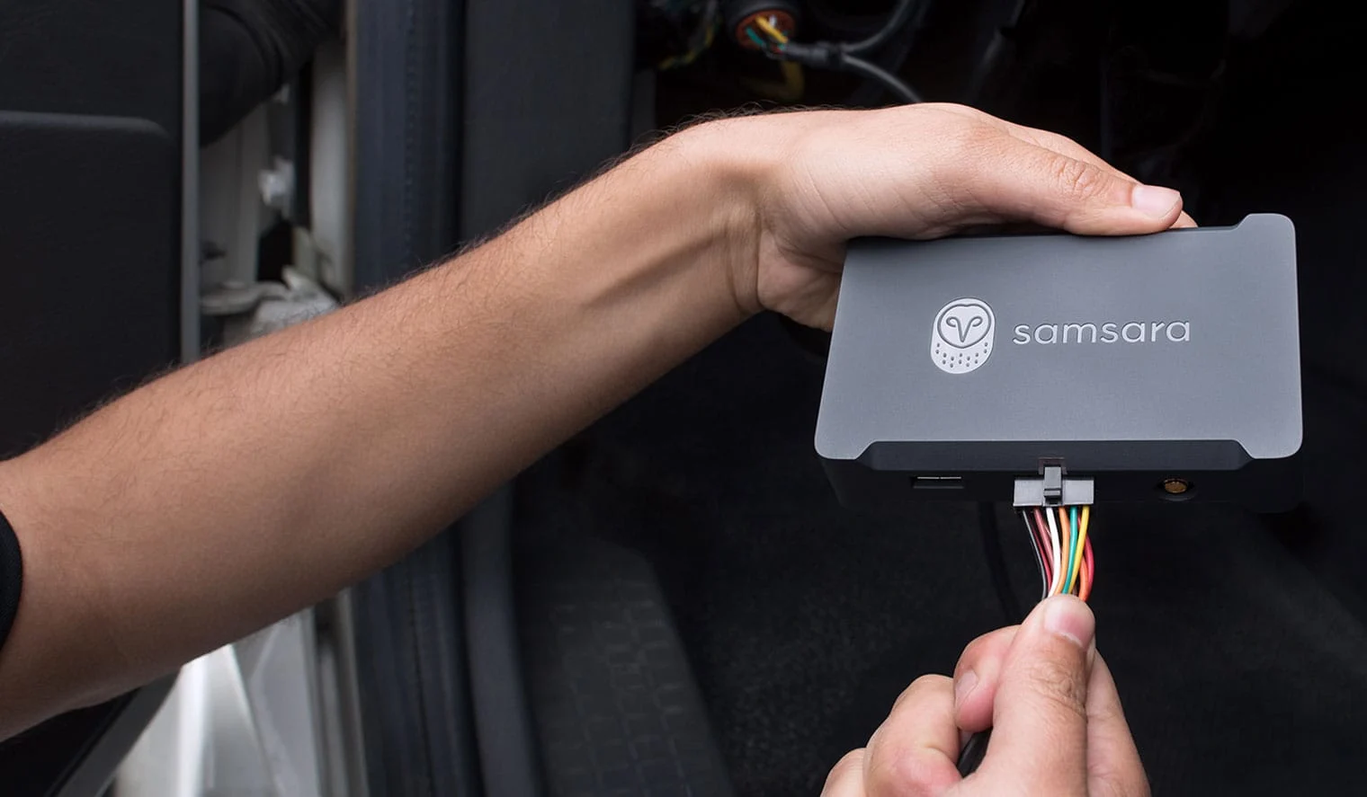
Today, Samsara is excited to announce three of our newest tools to help public works fleets elevate citizen services, improve public safety, and better utilize taxpayer dollars—during snowstorm season and beyond. These features are the latest additions to Samsara's suite of tools for public works fleets:
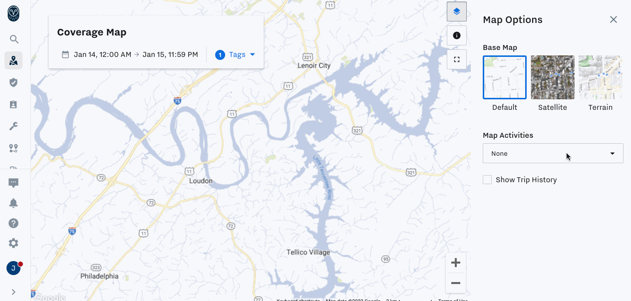
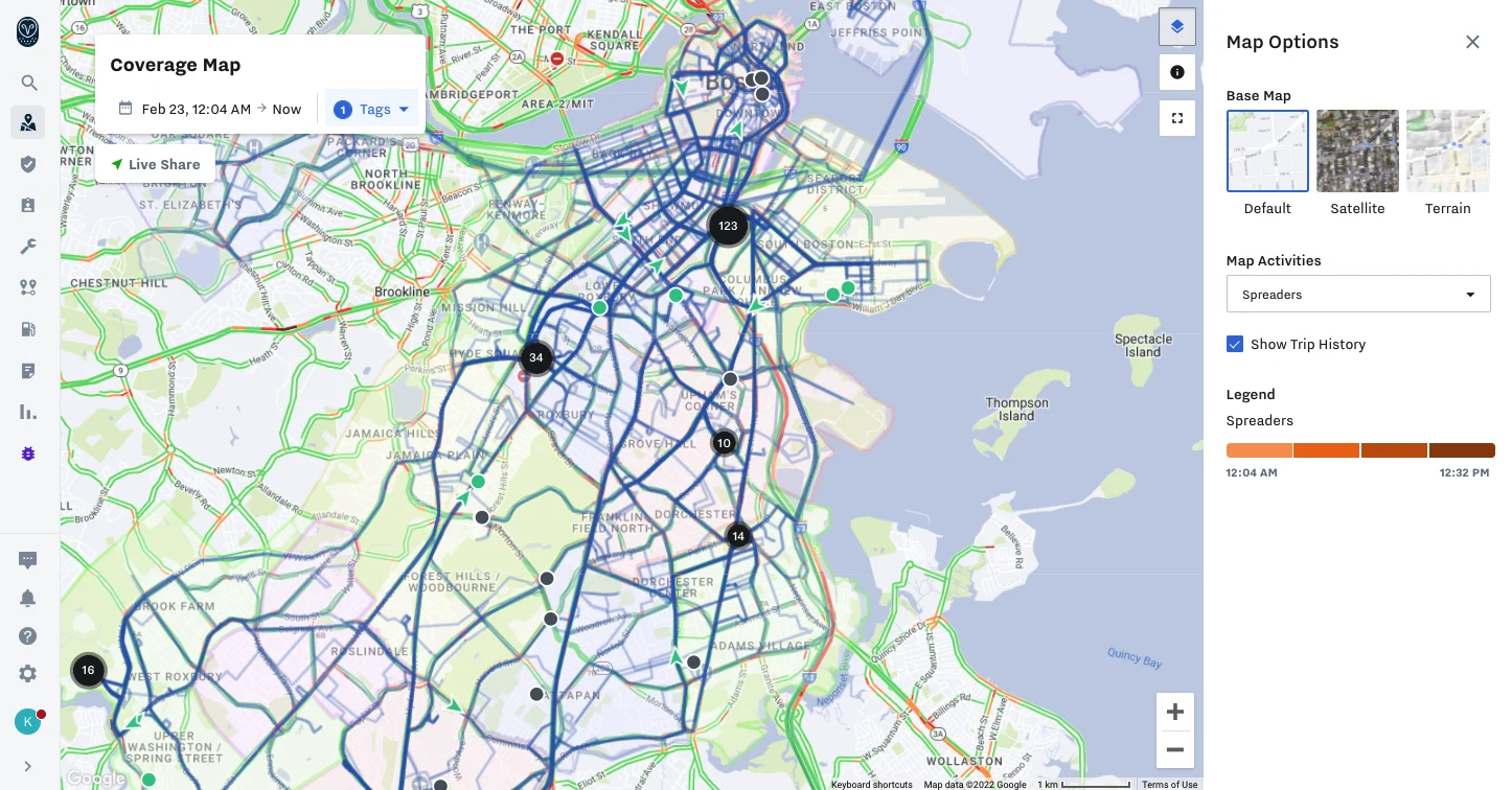
Coverage Map displays a real-time view of streets traversed by fleet vehicles over a specified time, letting administrators track progress.
Coverage Map Live Share lets administrators share a publicly-accessible view of the Coverage Map to communicate the status of services delivered to external stakeholders.
Material Spreader Integration connects data between Samsara and your existing third-party spreader system to maximize material usage and reduce costs.
Read on to learn more about these features and how our government customers are leveraging Samsara’s Connected Operations Cloud to deliver exceptional citizen services all year round.
Efficiently plan routes and monitor service coverage with Coverage Map
To maximize service efficiency and strategically plan routes for snow (or other debris) removal, public works administrators need visibility into the location and status of their fleet vehicles at a macro level.
With Coverage Map, you can see which roads have recently been serviced and which roads have not. Fleet administrators can monitor the location and activity of any service vehicle on a single pane of glass, accessing data on tagged vehicles, date and time ranges, trips, and more.
Coverage Map allows you to select a group of vehicles and report on different activities including:
Trip History: See what streets have been traversed and serviced.
PTO (power takeoff): See roads where PTO was engaged for selected vehicles.
Material spreader: See where and how much material, such as salt, is being utilized.
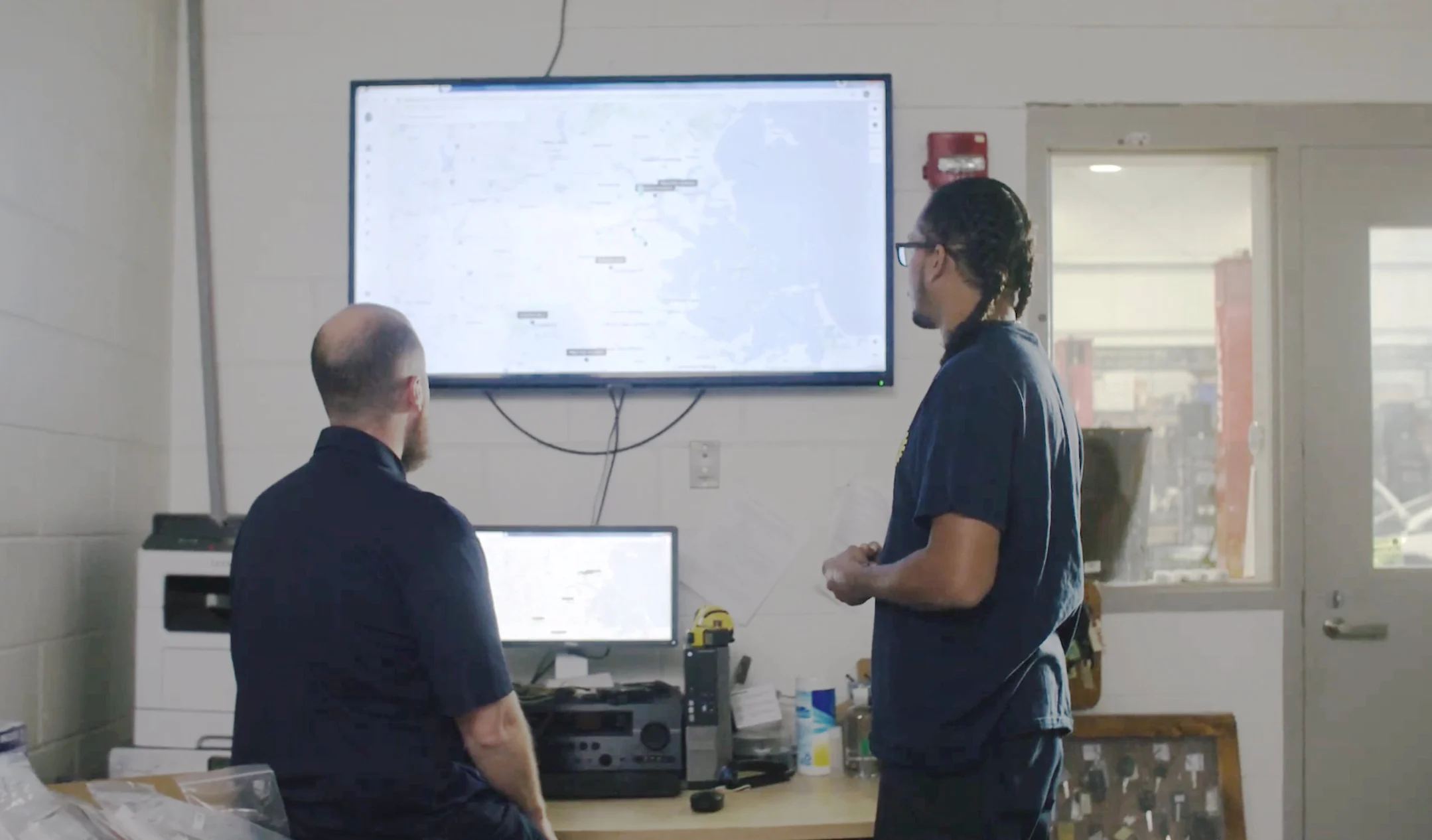
During this year’s snow season, the City of Boston used Samsara’s Coverage Map to improve service efficiency and keep citizens happy. “We have a constituent call number that gets blown up during the winter months with calls of, ‘My street hasn’t been plowed in days,’” said Robert Pardo, Logistics Specialist at City of Boston Public Works. “Utilizing Samsara’s Coverage Map has been great because we’re able to go in and see which district hasn’t had a street plowed, and we can deploy vehicles as needed.”
Seamlessly communicate service status to stakeholders using Coverage Map Live Share
Snowplows, street sweepers, waste vehicles, and other service-based vehicles operate on the front lines with citizens every day. While Coverage Map lets fleet administrators visualize the movement of their vehicles, citizens and other external stakeholders may also need to know when and where service has been executed.
Using Coverage Map Live Share, you can share a publicly accessible URL to view the Coverage Map of any of your tracked services with the click of a button. The map is configurable and can include by date range, tag, panic button, PTO, trip history, expiration date and more. Now, you can drive public visibility for your service status, reduce resident calls, and improve citizen communication.
In addition to Coverage Map Live Share, Samsara’s API integrations with third-party software make it possible to communicate service coverage to citizens using your existing tools—as the City of Syracuse recently did. “Now, with Samsara's GPS data and the platform's integration with Esri, we have a plow map that the public can access to see the last time a street has been plowed,” said Corey Dunham, Chief Operating Officer at the City of Syracuse. “They don't have to call the city to find out where the plows are; they can find it online. Not only do community members appreciate this transparency, but from the perspective of staff time, it's also made things more efficient."
Minimize material usage and costs with Material Spreader Integration
Chemical treatments such as salt and brine are also used for snow removal—in fact, over 15 million tons of salt are used each year to melt away snow and ice. While these materials are often necessary, they can quickly become both costly and environmentally harmful if used inefficiently. For example, salt splits into sodium and chloride when dissolved, contaminating waterways. According to the US Geological Survey, chloride levels were on the rise in 84% of urban streams had high chloride levels, with 29% exceeding federal safety limits of 230 mg per liter.
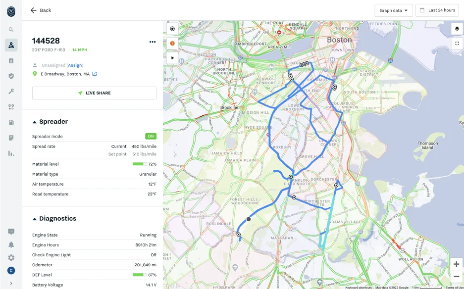
With this in mind, fleet administrators need to closely monitor material usage to ensure that cost and material waste are minimized. The Samsara platform is designed to be compatible with external tools, making it easy to get visibility into the usage of all your assets. Using the Material Spreader Integration, you can seamlessly flow data from your third-party spreader system into your Samsara Dashboard. By using this integration in conjunction with Coverage Map, fleets also gain visibility into service vehicles and road coverage. On your Samsara Dashboard, you can see spreader data such as the rate at which material is being used, material used in blast mode, ambient and road temperature, and more.
Be prepared for snow season and beyond
While snow and other seasonal challenges are often unavoidable, you can ensure that you’re well-prepared with Samsara. These features are just the latest additions to an existing suite of tools Samsara offers to help public works departments manage their diverse fleets—including integrated cameras to capture road conditions and manage safety, as well as features to support preventative maintenance, utilization monitoring, and more.
With Samsara's Connected Operations Cloud, government agencies can ensure their public works fleets are operating as efficiently as possible, so you can maintain road safety, improve cost savings, and maximize citizen satisfaction—during snowstorm season and beyond. At the City of Syracuse, Dunham said other nearby cities now look to them as a leader in using technology to solve problems in innovative ways. "It's exciting to be able to approach winter doing things differently and growing on the operation we already have," said Dunham. "Once we perfect the snowplow map, what else can we do? What other services are our residents asking for that we can deliver? To do things differently with Samsara is really exciting."
These features are available now for Samsara customers. If you’d like to learn more, check out this case study to see how the Township of Edison leverages Samsara to optimize snow operations. If you’re not a Samsara customer yet, get in touch with our team and see how our platform can keep your community safe and your citizens happy.
Get the latest from Samsara
Subscribe nowRead more

The hidden costs inflating your maintenance spend

Senior Product Marketing Manager

“The best mechanics choose the best tools”: Inside Samsara Connected Maintenance
Senior Product Marketing Manager

8 ways for fleets to manage surging fuel costs

Staff Product Marketing Manager

Tag it, find it, protect it: Announcing our smallest, most powerful Asset Tag yet

Senior Manager, Product Marketing


How better data can unlock insurance savings for your fleet

Director, Insurance Partnerships

The financial case for public sector innovation

Public Sector Field Strategist

How Southeastern Freight Lines gets new vehicles road-ready faster with Samsara’s PDI program

Senior Partner Marketing Manager

Samsara’s new extensibility toolkit: SDKs, connectors, and serverless functions

Senior Director of Product